Le carbone de l’Afrique: A Monitoring, Verification and Accounting Program for Africa
Africa plays a significant role in the global carbon cycle through direct contributions and as a key source of interannual variability. However, in-situ GHG measurements for the African continent are sparse and of short duration at any given location.
GHG measurements are urgently needed to address Intended Nationally Determined Contributions (INDC’s) articulated in the Paris Agreement. Verified INDC’s can only be acquired by direct ground measurements coupled with remotely sensed data. PαC intends to develop GHG measurement networks in selected countries of Africa to establish regional GHG pricing and trading platforms. PαC data will be available to private, public and governmental entities for research purposes.
GHG measurements cannot be made retrospectively, thus, the establishment of GHG measurement networks is urgent particularly in light of population growth scenarios for the African continent. Increased demand for energy and natural resources for food and wood products are likely to increase GHG emissions across the continent.
Collaborate with PαC to extend the reach of GHG measurement across Africa. Please complete our collaboration profile, here.
——————–
Selected References
Pelster, David, Mariana Rufino, Todd Rosenstock, Joash Mango, Gustavo Saiz, Eugenio Diaz-Pines, German Baldi, and Klaus Butterbach-Bahl. “Smallholder farms in eastern African tropical highlands have low soil greenhouse gas fluxes.” Biogeosciences 14, no. 1 (2017): 187-202.
http://www.biogeosciences.net/14/187/2017/bg-14-187-2017.pdf
Kim D-G, Thomas AD, Pelster D, Rosenstock TS, Sanz-Cobena A. Greenhouse gas emissions from natural ecosystems and agricultural lands in sub-Saharan Africa: synthesis of available data and suggestions for further research. Biogeosciences [Internet]. 2016 [cited 2017 Jun 17];13:4789–809.
www.biogeosciences.net/13/4789/2016/
Assouma, Mohamed H., Dominique Serça, Frédéric Guérin, Vincent Blanfort, Philippe Lecomte, Ibra Touré, Alexandre Ickowicz, Raphaël J. Manlay, Martial Bernoux, and Jonathan Vayssières. “Livestock induces strong spatial heterogeneity of soil CO2, N2O and CH4 emissions within a semi-arid sylvo-pastoral landscape in West Africa.” Journal of Arid Land 9, no. 2 (2017): 210-221.
https://link.springer.com/article/10.1007/s40333-017-0001-y
Ago, Expedit Evariste, Euloge Kossi Agbossou, Jean-Martial Cohard, Sylvie Galle, and Marc Aubinet. “Response of CO2 fluxes and productivity to water availability in two contrasting ecosystems in northern Benin (West Africa).” Annals of forest science 73, no. 2 (2016): 483-500.
https://link.springer.com/article/10.1007/s13595-016-0542-9
Valentini R, Arneth A, Bombelli A, Castaldi S, Cazzolla Gatti R, Chevallier F, et al. A full greenhouse gases budget of Africa: synthesis, uncertainties, and vulnerabilities. Biogeosciences [Internet]. 2014 [cited 2017 Jun 17];11:381–407. Available from: www.biogeosciences.net/11/381/2014/
http://www.wmo.int/pages/prog/gcos/documents/Biogeoscience_Valentini%20et%20al_Africa_GHG.pdf
Greenhouse gas emissions in Africa: Study summary and database.
http://ghginafrica.blogspot.com/


 Biodiversity (B) Avoided Carbon
 Gorilla Habitat (G) Avoided Carbon
 Methane (CH4)
 Indigenous Peoples (IP) Avoided Carbon
 Improved Forestry Management (IFM) Sequestration
 Afforestation (AF) Sequestration
 Agroforestry (GF) Sequestration
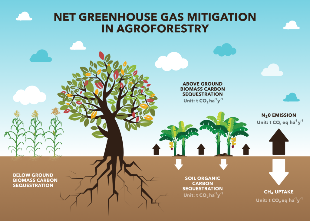
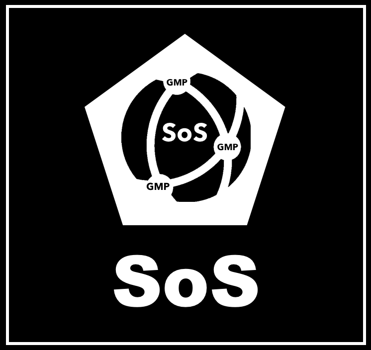 The System of Systems (SoS)
 QuantumQarbon
 Carbon isotopic analysis (IA)

 Carbon Dioxide (CO2)
 Working Forest Carbon Sequestration
 Eddy Covariance (EC)
 Soil Accumulation Chambers (SAC)
 Soil gas probes (SGP)
 Exsolvation of Dissolved CO2 (CO2(aqueous)) and CH4
 Vehicle Mounted Fast Response Gas Analyzers (VM)
 Unmanned Aerial Systems (UAS) and Remote Sensing (RS)
 A variety of UAS’s may be used in a project to record the status of forest conditions at low altitude (e.g., ~1,000 ft) on a routine basis, when a disturbance has occurred (e.g., hurricane, drought, timber operations) or for surveillance of forest activity by landowners or others accessing the site. Typical capabilities may include spectral imaging of the tree canopy and mapping functions to reveal differences along the flight path over time. In addition, UAS’s may also carry miniaturized gas sensors for CO2, CH4 and other atmospheric gases. The use of remote sensing (RS) for ecological research is well documented covering spectral bands for normalized difference vegetation index (NDVI), leaf evapotranspiration and other features of the biotic and abiotic project area.
 Flask Collection (FC)
 Nitrous Oxide (N2O)
 Sulfur Hexaflouride (SF6)
 Tree Plantation
 Perfluorocarbon (PFC)
 Water Vapor (H2O)